ArcGIS Spatial Analyst Model Builder
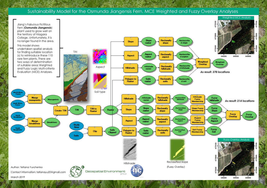
This assignment served as an introduction to the capabilities of ArcGIS Spatial Analyst extension and allowed for the development of an ability to undertake and understand multicriteria spatial analysis. As a part of this effort, the most suitable location (in the vicinity of Niagara College’s Glendale Campus) for the reintroduction of a rare (and entirely imaginary) species of fern was determined.
Geostatistical Analysis of Glendale Campus Humidity
The purpose of this assignment was to describe and analyze the collected data (humidity percentage in the vicinity of the Niagara College Glendale Campus) both geostatistically as well as practically. Also, it was needed to predict geospatial coverage by interpolation (creation of a continuous surface using both IDW and Kriging techniques based upon the sample points measured in the area).
Introduction to Statistics – Using MS Excel to Calculate Statistics and Visualize Data
This assignment served as an introduction to the statistical analysis and visualization of data using Microsoft Excel and R.
Purpose:
Purpose:
- To gain a basic familiarity with the techniques of statistical analysis,
- To display data graphically,
- To understand the extents of a given data set,
- To describe data in an objective and statistically meaningful manner.
