Remote Sensing
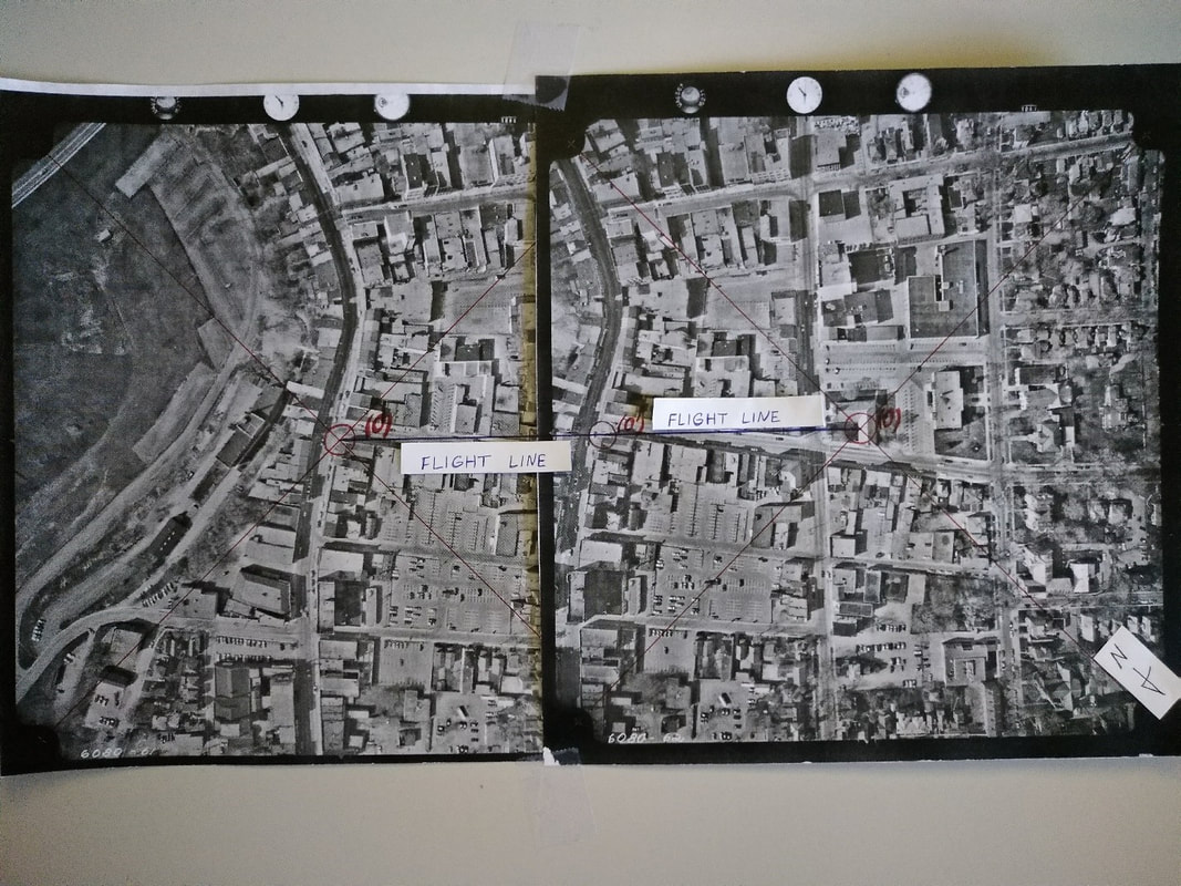
Stereoscope Usage, Elevation Estimates and Photogrammetry
|
This project served as an introduction to the use of Stereoscopic Aerial Photographs (Stereo Pairs) and basic Photogrammetric Calculations.
|
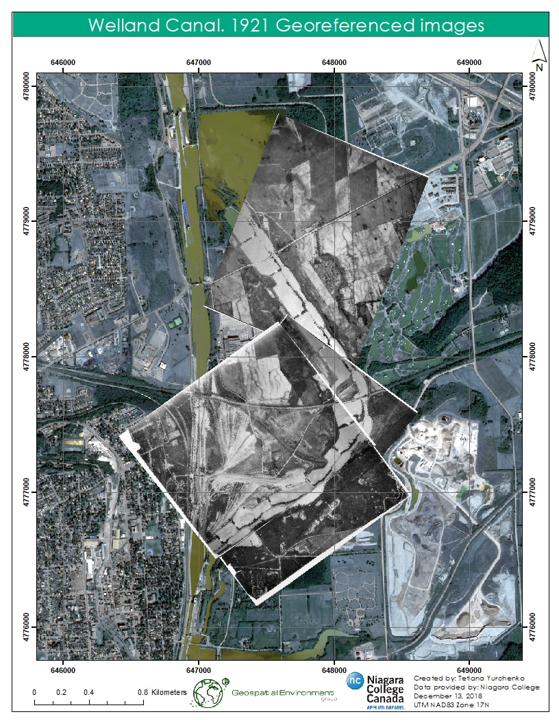
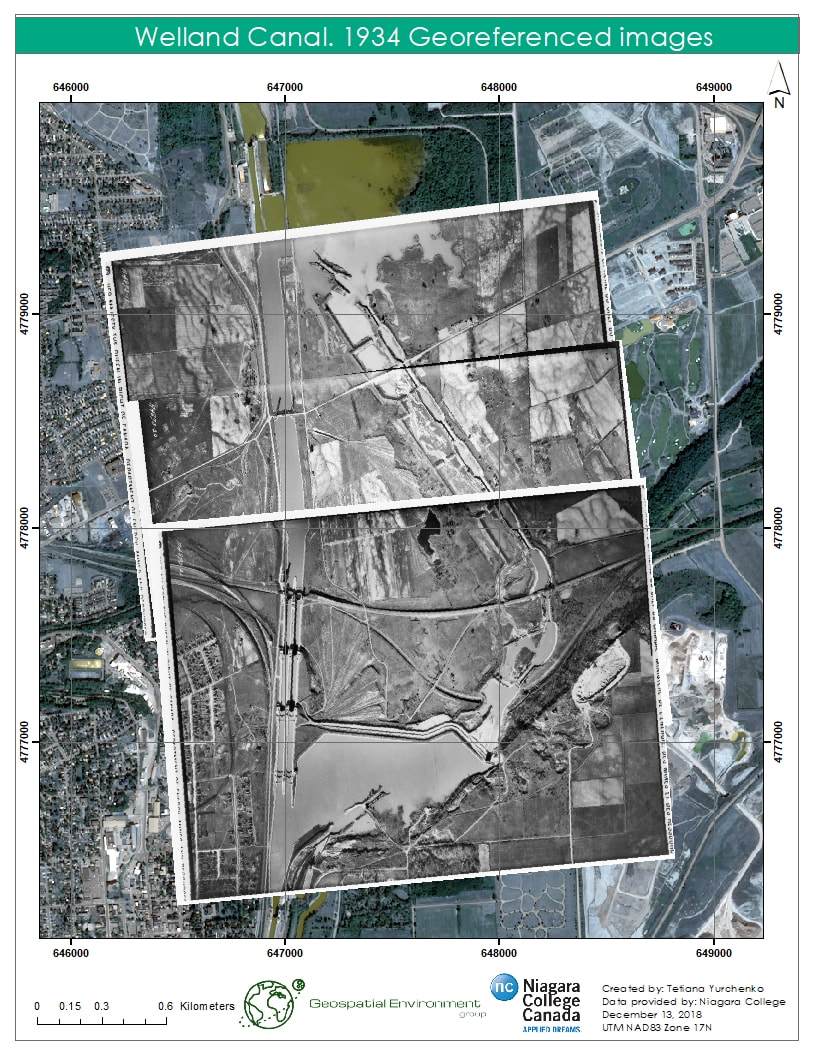
Georeferencing of Scanned Aerial Imagery and Change Detection
This project was focused on georeferencing of series of panchromatic aerial images of the eastern boundary of St. Catharines for stereoscopic viewing and full change detection analysis of this area of 4th and 3rd Welland canals.
|
|
Digital Image Processing
Unsupervised and Supervised Classifications
Principal Component Analysis


Click on image to extend it!
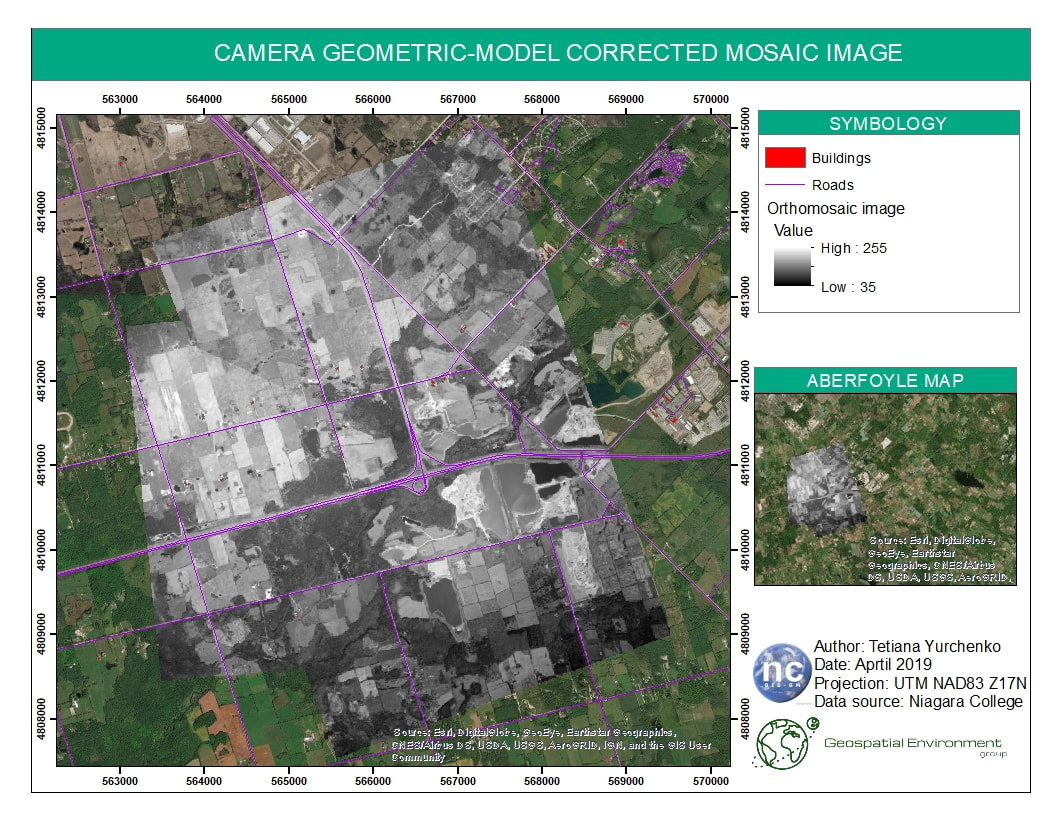
Geometric Correction, Orthorectification and Mosaicking