ArcGIS
Undertook a spatial analysis, using ArcGIS, for a number of wineries in the Town of Niagara-On-The-Lake, and report upon the findings of this analysis; demonstrated abilities in ArcMap, ArcCatalog and ArcToolbox to create a personal geodatabase and to analyze the spatial data that are a part of such a dataset.
Data classification
|
|

|
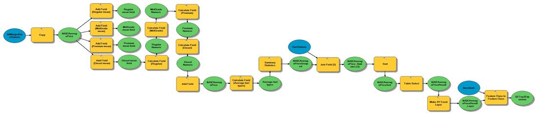
Using Model Builder to find top 3 cheapest gas stations, gas stations that sell diesel and top 3 most expensive gas stations
I designed a geodatabase in ArcGIS to manage information of Gas Stations from three cities of the Niagara Region, St. Catharines, Niagara Falls and Welland.
I collected gas prices data for six weeks. and used Model Builder to build three models: A model that finds the cheapest gas stations within ten kilometers of the Niagara on the Lake Campus of Niagara College, all of the gas stations that sell diesel fuel and the top three most expensive gas stations included in the data collected.
I collected gas prices data for six weeks. and used Model Builder to build three models: A model that finds the cheapest gas stations within ten kilometers of the Niagara on the Lake Campus of Niagara College, all of the gas stations that sell diesel fuel and the top three most expensive gas stations included in the data collected.
There are more ArcGIS maps in other sections!
QGIS

|
Watershed Mapping The assignment overviewed the possibility of high/medium/low risk of houses flooding in Welland. It was done using QGIS 3.2.0. The special technique was developed to justify the levels of risks of houses flooding |
Created a Map Book in QGIS to show regional and provincial roads clipped to Welland city extents and find the fastest way to get from one location to another one.
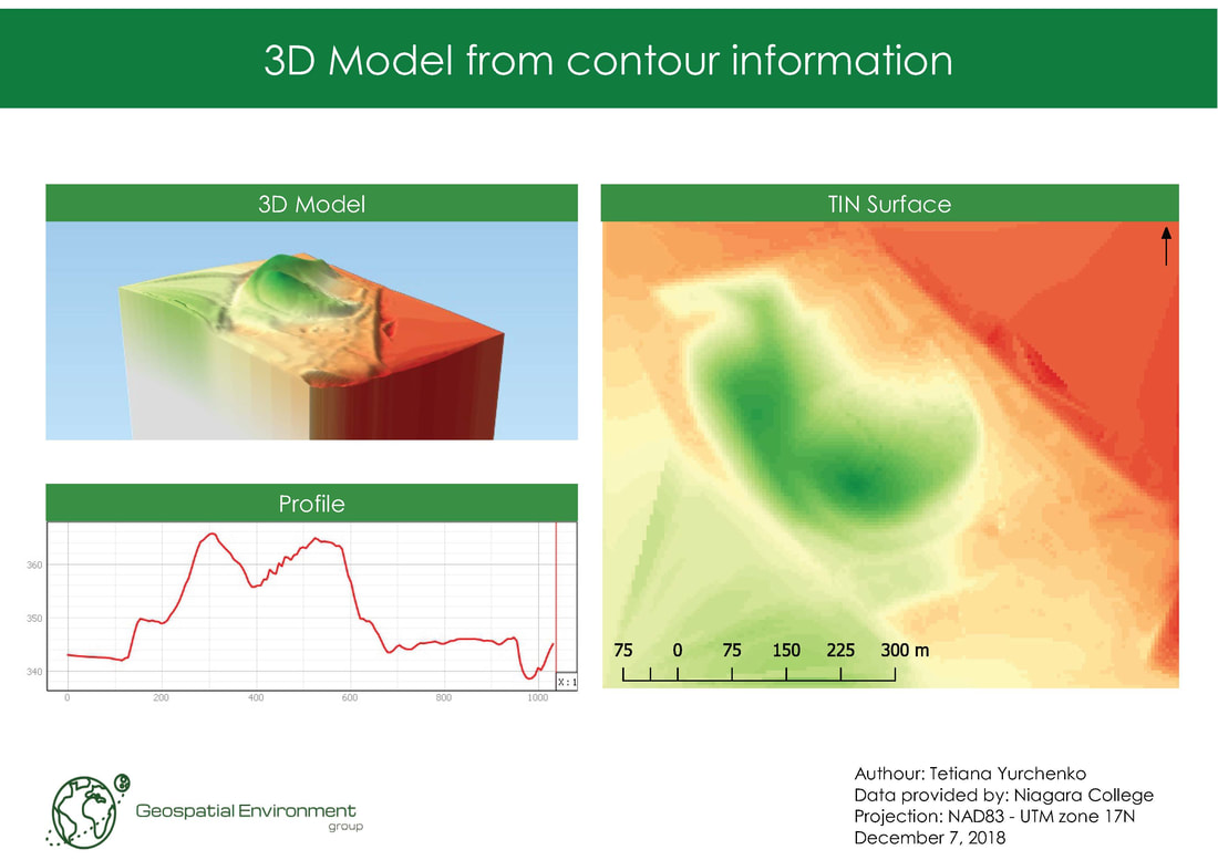
Created a TIN surface and 3D Model from the contour data using QGIS.
MapInfo
Gallery of some maps that were created in MapInfo.
